Bangkok Flood Latest: City Center Remains Dry But Unlikely to Hold Out
Amid the confusing and often contradictory reports on the flooding in Bangkok, I thought that I, as a resident of Bangkok, would offer my own take on the situation.
In the latest turn of events, Prime Minister Yingluck Shinawatra today claimed that Bangkok had a “good chance” of avoiding significant flooding, just 48 hours after she said that the capital would “definitely see flooding between 0.25 and 1.5 meters”. Such contradictory remarks from Yingluck and numerous other ministers have served to create enormous confusion amongst Bangkok residents, who quite simply don’t know what to believe any more. Yingluck stated that once we get through this weekend and the high tides pass their peak, Bangkok will face a much lower risk of flooding as the river will be unlikely to burst its banks anymore. Unfortunately, it seems that Yingluck is missing the point, like she has done repeatedly throughout this crisis. In my opinion, the biggest threat is not from the river, but from the massive wall of water to the north of Bangkok.
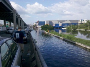
Two days ago I travelled to the north of the city, to the Rangsit district with a friend of mine to go and check on his submerged property. As soon as we passed the Don Muang Airport we could see nothing but water as far as the eye can see. We were wading through water up to my chest in places, easily more than a meter in depth. There truly is a huge amount of water being backed up by the city’s inner flood defenses, and although I am no expert in water management, I really cannot see how they can stop it from leaking into the city. Government ministers pledged that Don Muang’s defenses would not be breached. They were. Before that, they insisted that the Navanakhorn industrial estate to the north of the city would be saved. They were wrong again. And now they are saying that Bangkok will be okay. Can we trust them? I think not…
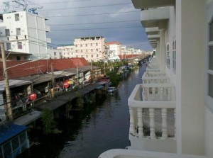
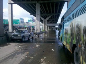
As it is right now, most parts of central Bangkok (and its major tourist areas) remain dry. However, flood waters are slowly encroaching into the city from the north, with the city’s second airport Don Muang (mostly used for domestic flights) now almost completely submerged. Thai website Sanook.com reported earlier today that Chatuchak Market is now at risk and could be flooded in the next two days. As for Suvarnabhumi International Airport, located to the south-east, it is for now out of reach of the flood waters and operating normally. There has been some localized flooding in areas of the city close to the Chao Praya River, including near Sanam Luang and Wat Pra Kaeow Temple, although these areas are only flooded for a few hours at a time, with the water receding once the high tides ebb away. However, the western side of the Chao Praya River, particularly the Pinklao district which is at a lower level than the eastern side, is almost completely underwater now. Google Maps have produced an interactive map of the Bangkok floods, which is kept up to date by local residents and is the best source of information I have found. Furthermore, ThaiVisa.com users can follow this thread for more Bangkok flood updates. It’s difficult to say for sure what will happen, and so I can only urge residents and tourists currently in Bangkok not to panic but at the same time, be ready for the worst.


LAst week, google maps showed Bang Phli as flooded and in urgent need of assistance. As I live there, I zoomed in to find out where – around Big c on Theparak Road so I went down there only to find the whole area bone dry, just like my house so don’t rely on Google!
Yes unfortunately that has been a recurring fact all through the flooding in Thailand. The media and others have reported all kinds of things. It’s hard to find reliable information anywhere. I guess Google is not much better then. Thanks for the input Keith. We’ll add Google to the list of unreliable sources.